
Our History

The geographical area known as Benton County is located within the traditional lands of the Kalapuyans, past and present.
We honor with gratitude the land itself and the people, who today are represented by the Confederated Tribes of the Grand Ronde and the Confederated Tribes of Siletz Indians, whose relationship with the land continues to this day.
Scroll through an agricultural history of Benton County below, from farming trends to the birth of conservation districts. This timeline provides a sense of context for the mission of the District and how the strategies we use to achieve that mission have changed with the times.
Benton County was created on December 23, 1847 by an act of the Provisional Government of Oregon. At the time of its formation the county included all the country west of the Willamette River, south of Polk County and running all the way to the California border in the south and the Pacific Ocean in the west. The county was created out of lands originally inhabited by the Klickitat, who rented it from the Kalapuyans for use as hunting grounds. All aboriginal claims to land within Benton County were ceded in the Treaty of Dayton in 1855. Portions of Benton County were taken to form Coos, Curry, Douglas, Jackson, Josephine, Lane and Lincoln Counties, leaving Benton County in its present form.
Benton County agriculture and conservation from the mid-1800s to the 21st Century.

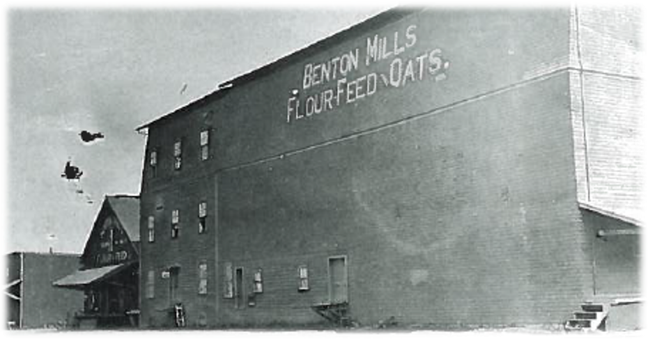


Fischer Brothers Milling Company reopens with an emphasis on feed and seed rather than flour in 1924.
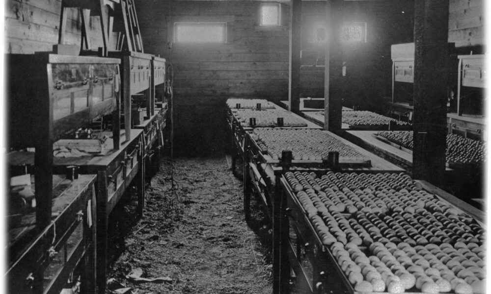
Sam H. Moore opens the Benton County Hatchery on the corner of Eleventh and Taylor streets, at that time the largest electric hatchery on the west coast.
Benton County Historical Museum, Harriet Moore Collection


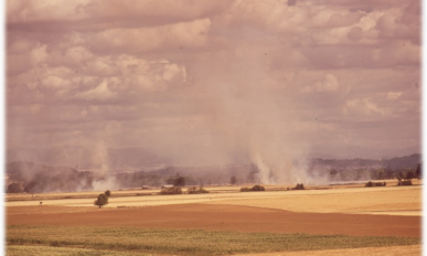
While testifying on Capitol Hill on April 2, 1935, soil scientist Hugh Bennett threw back the room’s curtains to reveal a sky blackened by dust. Congress immediately declared soil and water conservation a national policy and priority. The idea for soil and water conservation districts was born.

“The dust storms and floods of the last few years have underscored the importance of programs to control soil erosion. I need not emphasize to you the seriousness of the problem and the desirability of our taking effective action, as a Nation and in the several States, to conserve the soil as our basic asset. The Nation that destroys its soil, destroys itself.”
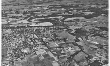
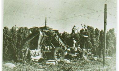


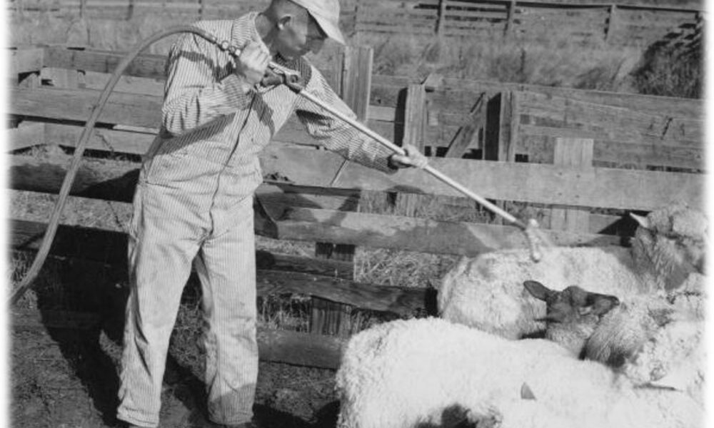
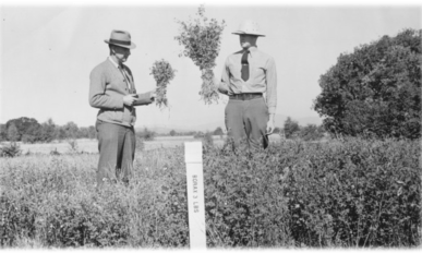
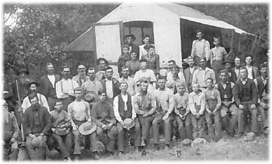
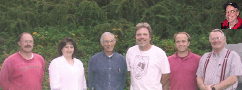
Photo from 1958 shows 8 of the 10 original District Supervisors. Seated around the table from left to right are: Virgil Lance, SCS work unit conservationist; Harold Werth, Benton extension agent; Kenneth Hilderbrand; John Neuman; CY Thompson; Don Hector, board chairman; Herb Seehafer; and Extension Agent S. A. Jackson. Two of the directors, Lester Powell of Kiger Island and Walter Hahn whose place is near Blodgett, were absent.


Standing L to R: Darrell Henderson, John Neuman, Herb Seehafer, Harold Werth; Seated L to R: Virgil Lance, Don Hector, C.H. Cy Thompson, Ed Joy, Lynn Clark, Walter Hahn (inset).

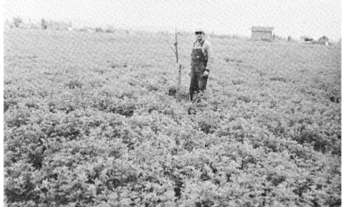
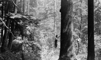
This is the first mention of Christmas trees in Benton Soil Conservation District’s records. Photo from H.L Schudel farm on Beaver Creek. Man pruning 5-year old trees.


True conservation means using our land resources to the full extent of their capability under a long-range management plan suited to the land and soil type.Benton Soil Conservation District’s 1965 Annual Report

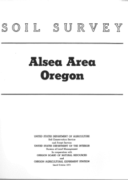
The soil survey for Benton County was completed by the soil scientists assigned to Benton SWCD. The soil survey is now an online tool.

The Clean Water Act (CWA) establishes the basic structure for regulating discharges of pollutants into the waters of the United States and regulating quality standards for surface waters.

W.V. Environmental Protection and Development Council produces report “Willamette Valley: Choices for the Future”

To learn more, visit the Oregon Explorer’s Willamette Basin resources.


“In the past ten years, the role of the District has changed tremendously…The District feels that there is a need to re-evaluate some of the earlier proposed projects.”
New terms floating around:
- Nonpoint Source Pollution
- Stream Corridor Management
- Land Conservation
- Greenway
- Outdoor Classrooms
- Water Pollution Control
- Environmental Conservation
- River Basins
The RCA establishes a national policy that soil, water, and related resource conservation programs shall be responsive to the long-term needs of the nation…
The 1985 Farm Bill aims to reduce soil erosion on highly erodible cropland and discourage conversion of wetlands into non-wetland areas.

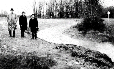
District signs were put up at three county lines including Benton-Lane on Hwy 99, Benton-Lincoln on Hwy 20, and Benton-Linn on Hwy 20.

The Agricultural Water Quality Management Act, also known as Senate Bill 1010, was passed by the Oregon Legislature in 1993. The Agricultural Water Quality Management Act requires the Oregon Department of Agriculture (ODA) to help reduce water pollution from agricultural sources.
Download this document to learn more:
WaterQualityandAgriculture.pdf- Restoring biodiversity
- Wetland restoration
- Reducing reed canarygrass
- Reappearance of vernal pool monkeyflower
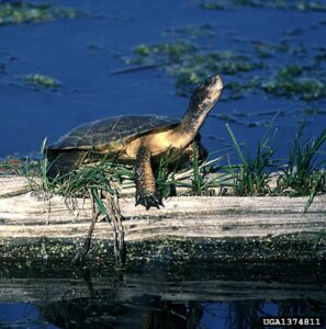
- Focus on habitat for western pond turtle, Oregon chub
Benton SWCD’s first plant distribution event was in 1993; 1,400 trees were distributed to 21 people. The second one had 69 customers for 5,000 plants and the third one (1995) reached 154 people with 6,311 plants and sales of $4,631. Mostly it was Douglas-fir and Ponderosa Pine and a lot of the trees were donated. The Boy Scouts helped out. Greg Paulson who was a horticulture professor at Linn Benton Community College was the BSWCD Board Chair and he got this going. At later sales his students came and helped.
Oregon signed a Memorandum of Agreement (MOA) with NMFS and earmarked $30 million to implement the Coastal Salmon Restoration Initiative on the condition that Oregon Coastal coho salmon were not listed as threatened or endangered.
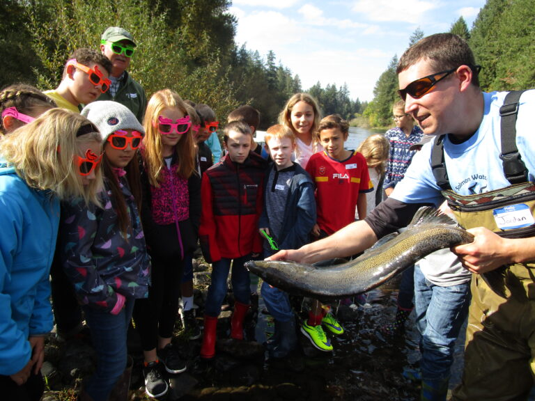
Ballot Measure 66 and Funding Ballot Measure 66, approved by voters in November 1998, amended Section 4, Article XV of the Oregon Constitution to dedicate 15 percent of net lottery proceeds; half to improve state parks and half to finance the restoration and protection of native salmonid populations, watersheds, fish and wildlife habitats, and water quality. This became an important funding source for District operations administered through the Oregon Department of Agriculture.
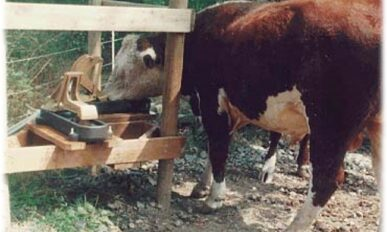
2006oregonsalmonplanf.pdfNose pumps for cattle installed to allow access to water while keeping livestock out of streams.
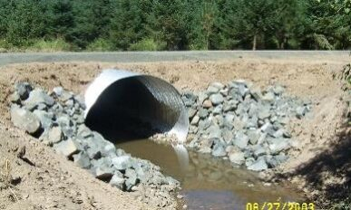
This cooperative effort involved compiling all available fish passage barrier and fish habitat inventory data in Benton County into one GIS database with the goal of identifying, prioritizing and planning fish passage and stream restoration projects throughout Benton County.
In April of 2004, BSWCD entered first agreement with Benton County Public Works Department to improve wildlife habitat and water quality.
In November 2004, Benton County voters granted a permanent property tax rate limit to the Benton SWCD (effective July 1, 2005), making the District a public taxing entity and enabling us to increase staffing levels and expand program offerings.
The Oregon Department of Environmental Quality designated parts of Benton, Linn, and Lane Counties as a Ground Water Management Area (GWMA) due to elevated nitrate in drinking water.

Between 2010-2012, 79 individuals from 27 organizations were involved in a planning process to collectively and collaboratively address invasive species issues – and develop a county-wide plan aimed at early detection and rapid response (EDRR) as well as outreach and education. The group achieved consensus in moving forward as a Cooperative Weed Management Area (CWMA) facilitated by Benton SWCD with four active sub-committees.
The Willamette River won the Thiess International Riverprize, an annual award given by the International River Foundation based in Brisbane, Australia. Riverprize recognizes outstanding, visionary and sustainable programs in river basin management and is the most prestigious environmental prize in the world. Portland-based Meyer Memorial Trust entered the competition on behalf of the many groups and individuals who are involved in efforts to improve watershed health across the Willamette Basin. Meyer Memorial Trust received a $300,000 award, some of which was used to establish the Willamette-Laja Twinning program with partners from the Willamette Valley in the U.S. and the Rio Laja basin in Mexico.
The Willamette Mainstem Cooperative (WMC) is a collaboration of landowners, organizations, and volunteers, coordinated by Benton SWCD, working together to promote, facilitate, and foster long-term stewardship of Willamette River resources with a focus on the Corvallis to Albany river reach. While significant effort had previously been directed towards improving the condition of tributaries of the Willamette, until the establishment of the Willamette Mainstem Cooperative, no organization had coordinated efforts to improve conditions along the mainstem Willamette River.

Benton SWCD chose Oak Creek and Jackson-Frazier Watersheds as our focus areas during these years. Several water quality improvements were implemented.

For more information about Focus Areas, download the document below:
WaterFocus2.pdfIn 2015, the board of BSWCD adopted its first-ever five year strategic plan. Click the image below to see the strategic plan.


Throughout the state, ODA partnered with SWCDs on Special Implementation Areas (SIAs). Benton SWCD and ODA chose Upper Muddy Creek as an SIA.

For more information about SIAs, download the following document:
SIA4.pdfOregon State Parks awarded Benton SWCD a plaque “in appreciation of your outstanding leadership and coordination of the Willamette Mainstem Cooperative” along with the following note:
“Please accept this token of our appreciation and gratitude for your contribution of time and resources to help improve the natural resources of Oregon State Parks. Your efforts help us achieve our mission to provide and protect outstanding natural, science, cultural, historic, and recreational sites for the enjoyment and education of present and future generations.
Thank you so much for your partnership and collaboration with OPRD to ensure the successful coordination of the Willamette Mainstem Cooperative. Your leadership has really paid off as evidenced by improved conditions on the ground and improved collaboration among entities work in this area. On behalf of myself, our former natural resource specialist Andrea Berkley, and park staff, we thank you!”
In April of 2020, Benton SWCD became the county’s Designated Weed Entity under the Oregon State Weed Board with support from Benton County Board of Commissioners.
What does the future hold for Benton SWCD?