
About Benton County
Present-day Benton County is located on the traditional lands of the Kalapuya tribes, who have lived here and cared for the area for thousands of years.
In 1847, Benton County was created from Polk County by an act of the Provisional Government of Oregon. It is one of seven counties in the United States to be named after Senator Thomas Hart Benton of Missouri, a longtime advocate of the development of the Oregon Territory.
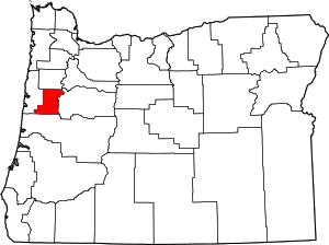
At the time of its inception, Benton County’s boundaries began at the intersection of Polk County and the Willamette River, ran as far south as the California border and as far west as the Pacific Ocean. Later, portions of Benton County were taken to form Coos, Curry, Douglas, Jackson, Josephine, Lane and Lincoln Counties, leaving it in its present form with 679 square miles of land area.
In Benton County there are five incorporated cities (Corvallis, Philomath, Monroe, Adair Village and North Albany) and five officially designated unincorporated communities (Alsea, Wren, Alpine, Bellfountain and Greenberry).

